
Open and inspect ADAC XML.
infrADAC Map turns an ADAC XML file into an interactive map of project information, assets, layers and structured attributes.
Supported host releases
Web browser
Desktop, Tablet and Mobile
- Desktop Supported
- Tablet Supported
- Mobile Supported
No CAD host or desktop installation is required.

Capabilities
Current free review tools.
Open the file, review the delivery data and use the included map tools.
Open ADAC XML files
Load one or more ADAC XML files directly in the browser or open the included example delivery.
Map delivery geometry
Display point, multipoint, line, polygon, dimension and annotation geometry from each loaded file.
Review project and file details
Inspect the receiver, schema version, coordinate system, drawing extents, surveyor, engineer and source software information.
Inspect assets and ComponentInfo
Select a mapped asset to review its identity, structured properties, ComponentInfo values and linked files.
Filter and restyle the map
Filter asset classes or construction status, control individual visibility, show labels and set display colours.
Check the loaded delivery
Identify receiver, schema, datum and drawing extent issues, duplicate ADAC IDs and assets outside the declared extents.
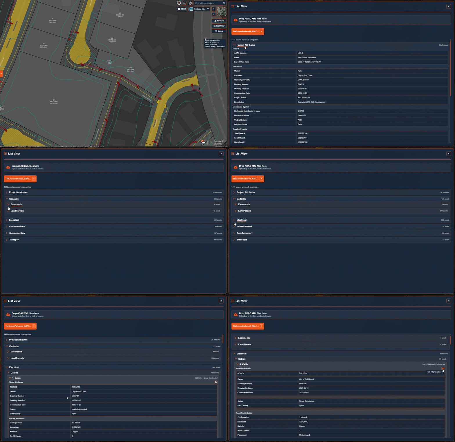
Use grouped List View
Review project attributes and every loaded asset in a structured list linked to the map.
Open supporting files
Load SupportingFiles.zip and open the files referenced by each asset.
Measure and use Street View
Measure distance, area and coordinates, then open Street View at a selected map location.
Add council and utility context
Display council or utility boundaries and add published REST service layers to the map.
Start a live review room
Share the map in a live collaboration room using the included free room capacity.
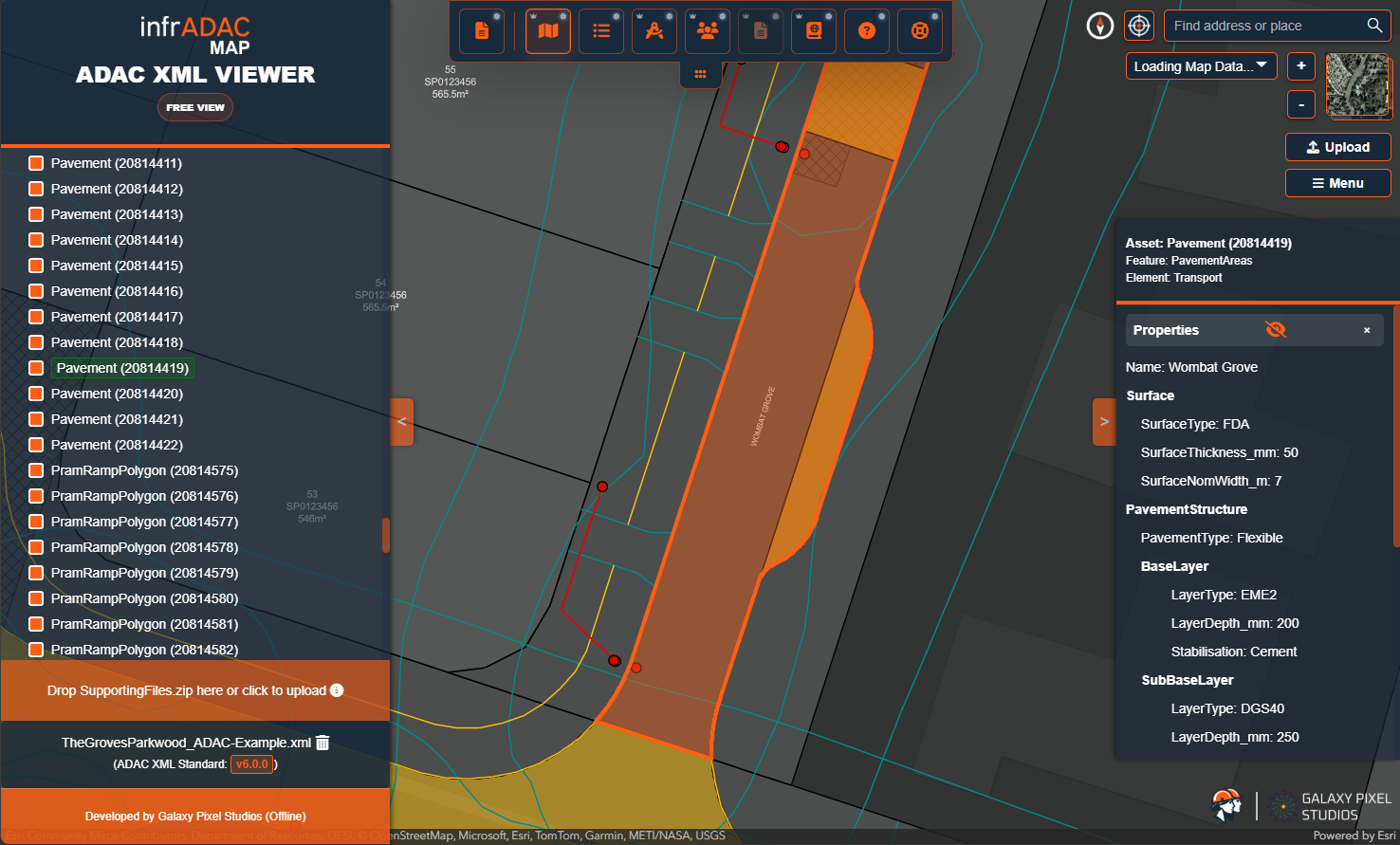
Asset inspection
Inspect mapped assets and their attributes.
Select an asset from the map or asset list and review its identity, ComponentInfo and structured properties together.
Host integration
What Map adds to the review process.
No design host required
The reviewer does not need AutoCAD, BricsCAD Pro or 12d Model to inspect the exported ADAC XML.
Map and list work together
Mapped geometry, the structured asset list and the attribute panel provide different ways to find the same delivery information.
Use the delivered file
Map reads the ADAC XML output; it does not replace the authoring and profile audit work performed in ACAD, BCAD, DCAD or MCAD.
Workflow
From setup to a reviewable ADAC delivery.
- 01
Open
Choose the ADAC XML file in infrADAC Map.
- 02
Navigate
Use the map, layers and asset list to find the project information under review.
- 03
Inspect
Select assets, read their attributes and check the available supporting information.
List View
Review the full delivery in a structured list.
Move through project information and grouped assets in List View, with each selection linked directly back to the map.
Council and Utility directory
Open the receiver guidance associated with a delivery.
-
 Bundaberg Regional CouncilQLD · Council
 -
 City of Gold CoastQLD · Council
 -
 City of IpswichQLD · Council
 -
 City of Moreton BayQLD · Council
 -
 Gladstone Regional CouncilQLD · Council
 -
 Gympie Regional CouncilQLD · Council
 -
 Logan City CouncilQLD · Council
 -
 Mackay Regional CouncilQLD · Council
 -
 Noosa CouncilQLD · Council
 -
 Port of BrisbaneAuthorities · Council
 -
 Redland City CouncilQLD · Council
 -
 Rockhampton Regional CouncilQLD · Council
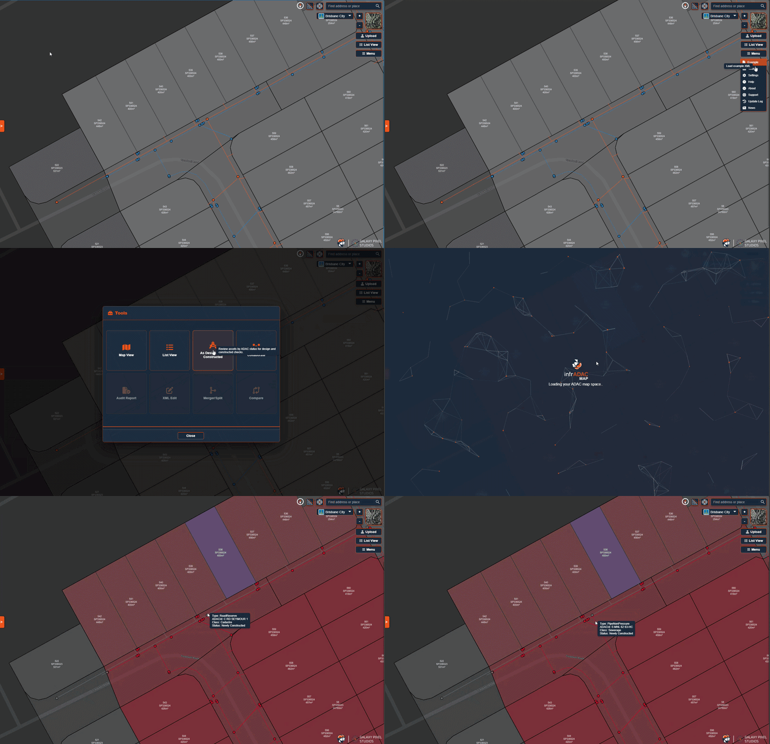
Map modes
Compare As Design and As Constructed data.
Switch between the As Design and As Constructed map modes to distinguish proposed and completed asset data during review.
Licensing
Free ADAC XML review.
infrADAC Map is available to all users at no extra cost.
Available at no cost
No paid licence or Plugin seat is required to use infrADAC Map.
No design host installation
Open the service on a current desktop, tablet or mobile device.
No seat management
Map does not require computer activation, a floating checkout or a network licence server.
Current release